Explore and Capture with GPS Map Live Earth Camera
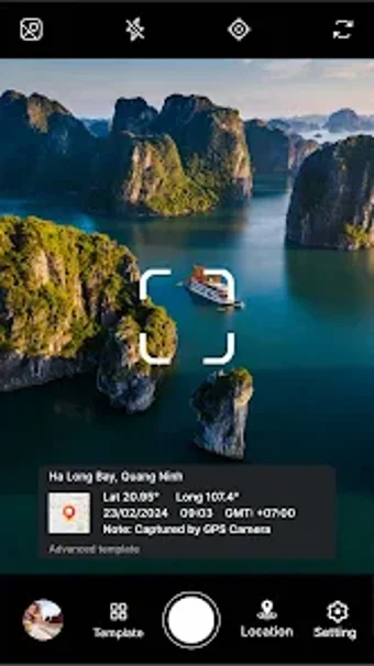
GPS Map and Live Earth Camera is a versatile Android application designed for travelers and explorers, combining GPS technology with high-quality photo capture. This free app allows users to geotag their photos, automatically embedding GPS coordinates into images, ensuring that every captured moment is linked to its exact location. Additionally, timestamps are added to each photo, helping users preserve the story behind their memories.
The app features an integrated Live Earth Map, enabling users to visualize their journeys interactively. With Street View Mode, users can explore locations virtually before arriving. Its intuitive interface caters to all users, while offline functionality ensures that essential features remain accessible without an internet connection. Privacy options are also included, allowing users to manage location data effectively.